Excursion to the Waldnaab valley
Waldnaab valley. Wildly romantic!
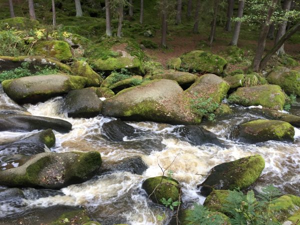
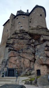
Autumn is ideal for outings. Get some fresh air instead of heating air and get out into the daylight to collect vitamin D! An hour’s drive north of Regensburg, near Falkenberg in the Upper Palatinate Forest, lies a wonderful excursion destination: the Waldnaabtal nature reserve. Picturesque rock formations and 30 to 50 meter high granite cliffs line the river bed here. The river itself meanders picturesquely through the valley, where it is repeatedly diverted by large, moss-covered boulders and debris. Sometimes rippling, sometimes roaring. From the Hammermühle hiking parking lot, the trail leads past the Mühlnicklweiher pond and down into the valley. Approximately in the middle of the circular trail is a managed log cabin (March to October, November closed, December to February only Saturday & Sunday). A riverside path leads back along the river. There is a lot to see along the way, e.g. the “butter churn”, the “Sauerbrunnen”, the “Tischstein” or the “Kammerwagen”. Legends often surround their origins.
At the “Butter Churn”, a plaque explains a legend: “Knight Kuno pursued the fair maiden. She jumped into the water in her sorrow, reached the other shore with luck and looked back at her pursuers. She was not turned into a tree like Daphne, but he was turned into a rock with squires.” Since then, lamenting sounds have allegedly sometimes been heard in the evening. Anyway, here the river meanders particularly beautifully and wildly past the unique rock formations and here you can see the hollow shapes in the granite created by water eddies, which probably gave the place its name.

The Sauerbrunnen has been known for centuries. Today the spring is accessible via a few steps. The water is said to have healing properties… but you’d better not try it.
The river name “Naab” is Indo-European and means something like wetness, water, mist, fog or cloud. However, the name of the valley is derived from the “Tirschenreuther Waldnaab”.
Starting point: Hammermühle hiking parking lot. Coming from the A93, at the Falkenberg town sign, follow the sign for the car hikers’ parking lot on the right and turn left at the next fork to the parking lot with hiking signs. From the Hammermühle parking lot via Kammerwagen, Sauerbrunnen, Butterfaß, Blockhütte, Mühlnickelweiher, Kalvarienberg, Hammermühle and back to the parking lot circular route approx. 8 km / easy / approx. 2 hours. The rocks are quite slippery in places, so hiking boots are recommended.


(unpaid advertising due to naming and shaming)
Our excursion tips on Facebook:
Do you already know our Facebook group “Excursion tips in and around Regensburg plus Upper Palatinate” with more than 22,000 members? Click here for the group.
RegensburgNow.de has over 40,000 readers per month and is a site of the RegensburgNow agency
If you are interested in advertising on RegensburgNow, please write to us at mail@regensburgnow.de

Don’t miss a thing! Subscribe to our newsletter:
Want more tips? Then please click here:


